Upper Tampa Bay Trail
Tampa definitely is an urban area. There is no doubt about that. But the Upper Tampa Bay Trail is actually a decent greenway that is available to residents and visitors alike.
Upper Tampa Bay Trail
This is part 1, the lower part of the Trail:
https://youtu.be/NUZ958DYUOA
This is part 2, the upper part:
https://youtu.be/vUrhy7wWf9E
How to Get There
Being an urban trail, there are a lot of options for getting to the Upper Tampa Bay trail (both paid and free). Unfortunately, they still have not completed the entire trail so as of this writing it is basically two separate trails.
Upper Tampa Bay Trail Main Section
If you want to start at the southernmost point of the trail, make your way to the Memorial trailhead.Ehrlich road is another option if you want to enter in the middle of the trail. The main part of the trail ends at Peterson Road Park.
Upper Tampa Bay Trail North Extension
The northern extension can be picked up at Keystone park just north of Van Dyke Road, the Lutz Lake Fern Trailhead and ends at the Suncoast Trail.
Here is the list of trailheads courtesy the Hillsborough county web site:
Trailheads and Access south to north:
- Memorial Trailhead: 7499 Montague Street
- Cold water and parking
- Directions: Take Hillsborough Ave. west past the airport, Memorial Highway and Sheldon Road. Turn right on Montague Street. Follow Montague to the trailhead a short distance on the right.
- Channel Park Trailhead: 9201 W. Waters Avenue
- Restrooms, parking, water and drink machines
- Directions: Hillsborough Ave. West to Sheldon Road. Turn Right (north) onto Sheldon Road to Waters Ave. Turn left (west) onto Waters Ave. The trailhead is a very short distance on the right.
- Wilsky Boulevard Trailhead: 10314 Wilsky Blvd.
- Parking, cold water and restrooms
- Directions: From Tampa, take Waters Ave west to Hanley Ave. Head north on Hanley Ave, Hanley becomes Wilsky Blvd at Linebaugh. Cross Linebaugh, the trailhead is on the left/west side of Wilsky Blvd., before the on ramp to the Veterans Expressway.
- Ehrlich Road
- Parking, water, map
- Directions: From Tampa, take Ehrlich Road west toward Gunn Highway. The trail parking area is just east of Gunn Highway, south of Ehrlich, and adjacent to an old house. It is not directly on the trail and could be easily missed. The trail is two houses to the west, just before the intersection, next to Bally Hoo Restaurant. The water cooler and map are just south of the parking along the trail.
- Peterson Park: 8203 Peterson Road and Rails Road
- Parking, restrooms
- Directions: From Tampa take Gunn Highway north. Peterson Road is a mile north of the Gunn Highway/Sheldon Rd intersection at Sickles High School. Turn right onto Peterson Road. The park and the northern terminus of the trail are located ½ mile on the left.
- Lutz Lake Fern Trailhead: 7020 Lutz Lake Fern Road
- Parking, restrooms
- Directions: On the south side of Lutz Lake Fern Road east of Gunn Highway and west of the Veterans Expressway.
What to Do at the Upper Tampa Bay Trail
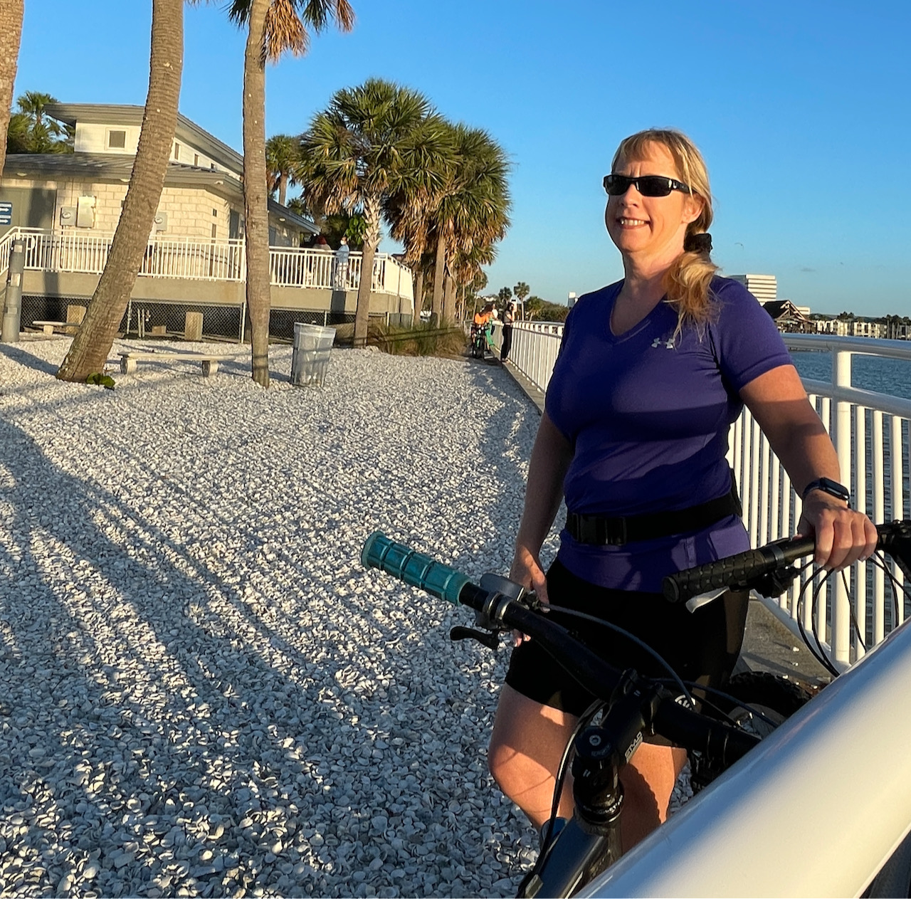
The Upper Tampa Bay trail is definitely oriented to biking and walking. It is completely paved and well-maintained. The asphalt may be a bit too rough for rollerblades, but we did see people doing it!
Biking Campbell Causeway
The Courtney Campbell Causeway in Clearwater/Tampa is definitely one of the unique fun things to do in the area.
https://youtu.be/vNbamZUtuOs
Courtney Campell Causeway
How to Get to It Courtney Campbell Causeway
Courtney Campbell Causeway is one of the main arteries between Tampa and Clearwater. It is pretty close to the Tampa airport, and comes out near Safety Harbor on the Clearwater side. One simple place to park (paid) Ben T. Davis Beach Park - map here. A little further away is a neighborhood park called Cypress Point Park , but will put you further away from the causeway. There is also free parking along most of the causeway, so if you don't mind starting in the middle, that is always a good option! Don't forget - this place can be VERY busy during the weekends. Crowds can be big, and parking can be tough.
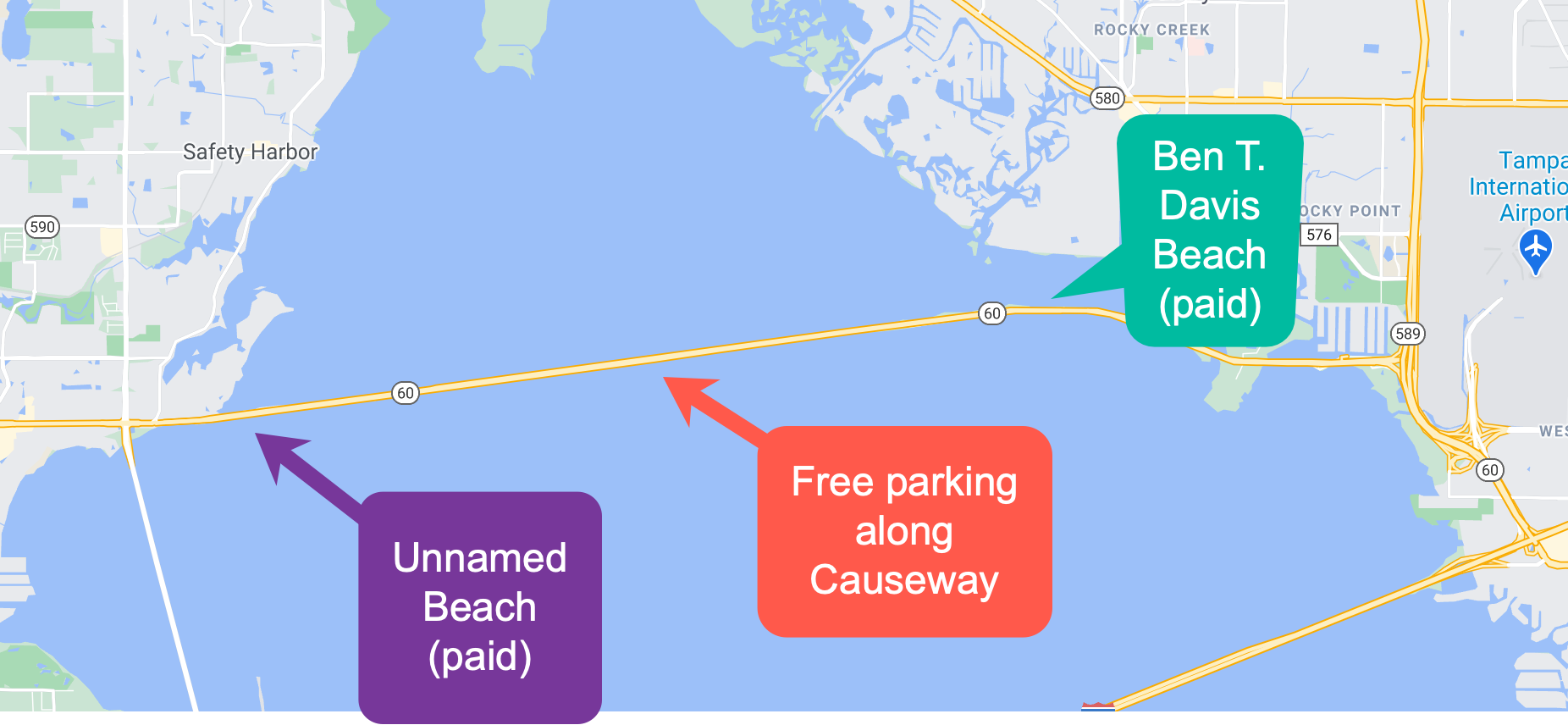
Another option on the south side close to Clearwater is a paid beach lot. The sand is really nice there and it can be a bit quieter than anything on the Tampa side.
Things to Do at Courtney Campbell Causeway
Courtney Campbell Causeway is a great place to hang out when the weather is nice! Especially during the week, when you can avoid the biggest crowds. Biking is always a favorite here, along with walking. Because the path is so well maintained, roller blades or roller skates are also really good options. We mainly biked there because we wanted to cover a lot of ground. Most people use the causeway to hang out, have picnics, or chill with friends. On the Sunday we visited it seemed to be "battle of the car stereos" in may areas, and the volume in a couple cases was excruciating. If that's not your thing, definitely go during the week!
One thing to be aware of - the breeze off the bay can be very strong on many days. When we biked, the headwind was almost unbearable going from the Clearwater side over to Ben T. Davis beach. But we were rewarded with a tailwind that made our mountain bikes feel almost like electric bikes! So it can be a trade-off, but something to be aware of.
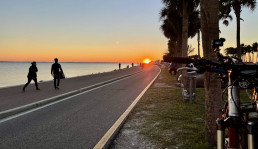
One of the nicest things we enjoyed was the sunsets - you can't beat watching the sun set over Clearwater. Almost anywhere along the causeway has a good view for a sunset!
Bathrooms
The only public bathroom we found was at Ben T. Davis beach. It was small, but we never had to wait very long even when we went on the weekend. If your bladder is small, you may want to plan your trip so you can hit this area if you need to go! Or don't drink a lot of coffee or water before your visit!
Fishing
A lot of people were fishing close to the Campbell Causeway bridge, and also on the north side of the Causeway. Just east of the bridge is the causeway boat launch. As of this writing, parking is $5 and it is a pretty large boat launch. There also usually is porta potties if you really need to go!
Food Options
Not a lot of food options right on Campbell Causeway, but one notable fun place is Whiskey Joes - They can be super busy, but the view is amazing and this is probably the closet you can be to Tampa and feel like you are in the middle of nowhere at a beach! Since they are on the south side of the causeway, they also get that great sunset view.
Because this is really an urban area, once you leave the causeway in either direction you can find a ton of food options. But if you want to save money, pack a picnic and enjoy your food on the causeway!

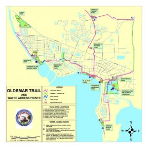
Oldsmar Trail Hiking
We have spent most of the Winter of 2021 in Tampa, close to the city of Oldsmar. And one thing we discovered is that Oldsmar trail hiking is far more interesting than you would expect. Even though it is very urban in this area, they have done a decent job of making a set of hiking trails, connected by mostly residential streets. They claim there is 11 miles of trails, and that sounds about right!
Oldsmar Trail Hiking
What we ended up doing is starting at the center of the Oldsmar parks (which has the most parking lots) and then breaking our hikes into three distinct sections, each with unique quirks and features - each hike allowing us to get easily up to 8 miles round trip on a bike or a hike.
Our Oldsmar Trail Hiking Starting Point
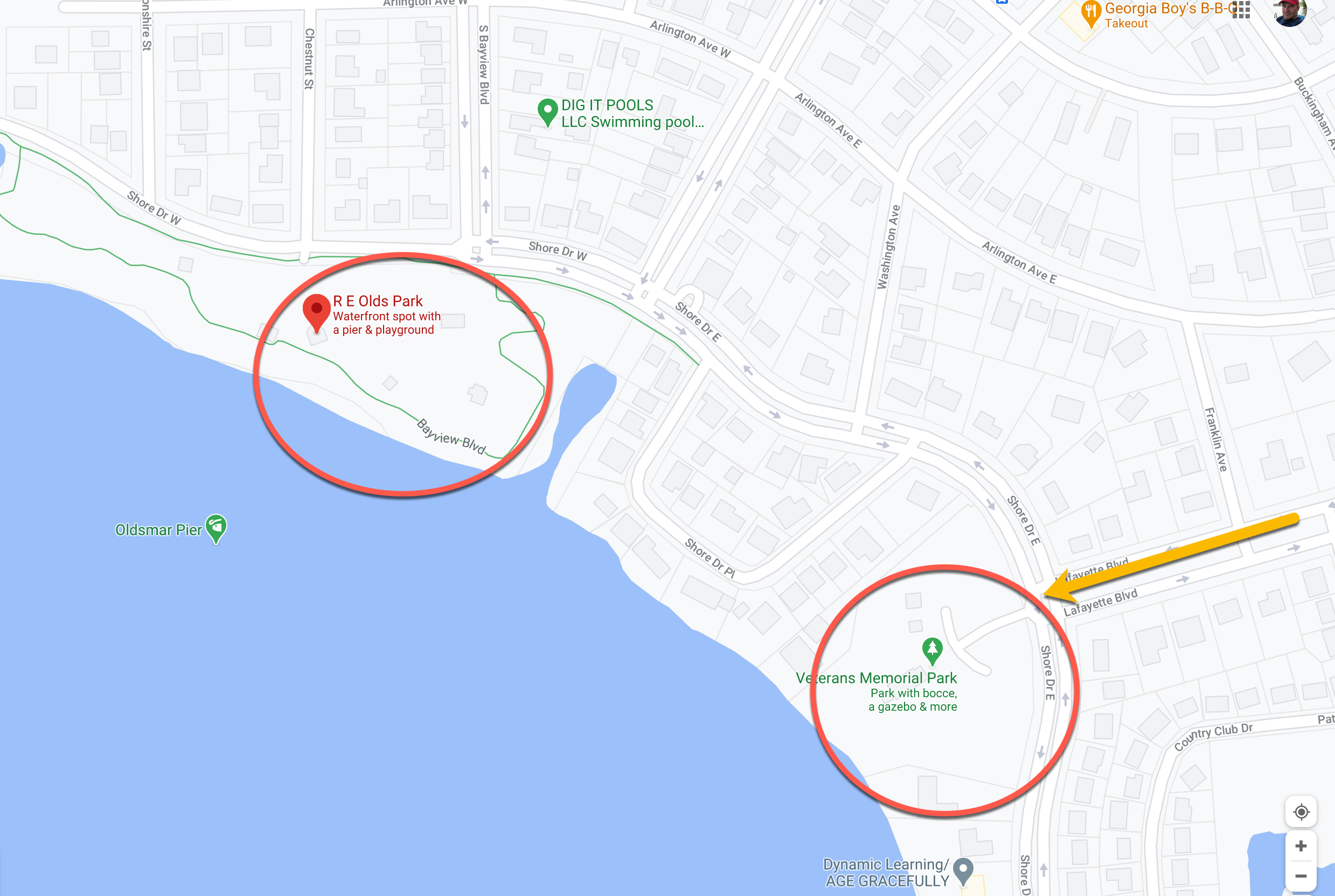
We always start our adventure at the same spot - one of the many parking lots at R.E. Olds Park or the parking lot at Veterans Memorial Park. We could start Sheffield park (they also have free parking) or xxx. Mobely park is another option, but that is paid parking so unless you want to start at that one because of the beach (not that great of a beach) then don't bother.
We found it easiest to go down Lafyette road (off Tampa rd/580 and opposite Race Track Rd) to get to these parks.
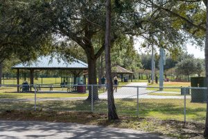
The parks themselves have plenty to offer - a lot of playgrounds for the kids, restrooms, pavilions and decent access to the water. The parking has always been safe, and the crowds have been pretty decent (although this is winter during a pandemic, so your mileage may vary). Once we park, we then have 3 major loops we can take depending on our mood. Each require some surface street walking, but will reward you with some very pleasant trails and access to even more parks and beaches!
Lake Tarpon Canal Route
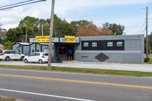
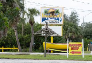
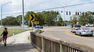
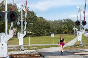
Our first route and probably favorite goes to the Lake Tarpon Canal and ultimately to the Oldsmar Sports complex/BMX park (shown as Canal Park on the map above). If you start at R.E. Olds Park, once you get through the park (which is a nice walk itself) you will then be on surface streets. Not too bad (you will pass the Herp shop, which sells reptiles), and Jack Willie's bar. Once you pass Jack Willies you have to cross 580 - be careful! The drivers here are crazy! Once you have crossed 580, go past the railroad track and look to your left - you will see the trailhead entrance.
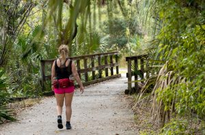
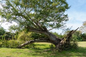
Some of the sights along the way!
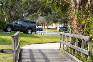
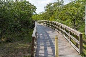
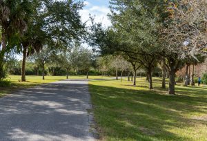
Once you're on the trail it's really nice! This takes you through Moccasin park which has a few dirt trails that you can explore. The main trail through here is paved and has well-maintained wooden bridges. After you walk this part of the trail, you will enter a residential street (3rd photo).
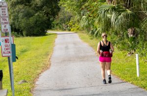
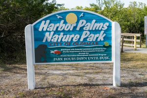
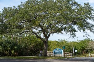
Walk down this street for about 10 minutes and you will make it to the Harbor Palms Nature Park trailhead.
This is the map to Sheffield park (click to expand):
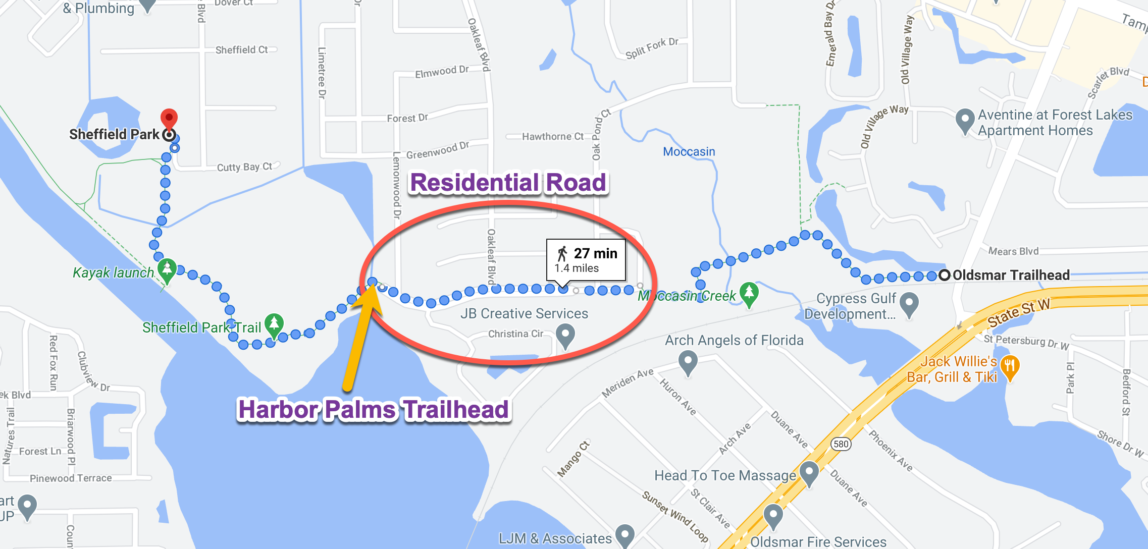
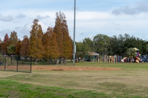
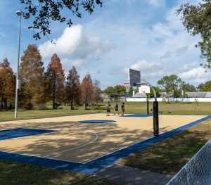
At the end of this section is Sheffield Park. The park has ball fields, basketball court, playground and a nice pavilion. Most importantly it has bathrooms! You are roughly at the 2.5 mile point if you start at R.E. Olds Park. So plan on at least a 5 mile hike if you make it to these bathrooms! There is also free parking available if you want to start from this park.
Mobely Beach Route
Cypress Park Route


